Why a Roman emperor built a wall across England
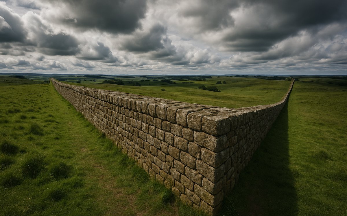
AD 122: Hadrian's visit and the order to build
This isn't a story about "keeping out barbarians" in the way the phrase gets used casually today. Construction began in AD 122, the year the emperor Hadrian personally visited the province of Britannia. The 4th-century biography collection known as the Historia Augusta records that Hadrian was "the first to build a wall, 80 miles long, to separate the Romans from the barbarians" — one of the only ancient sources that directly names his reasoning, even allowing for how loosely history was written centuries after the fact. Rather than the empire's absolute limit, most historians read the wall as a controlled, taxed frontier crossing point and a show of Roman military capability as much as a defensive barrier against invasion.
How it was built: milecastles, turrets, and forts
The wall wasn't a single uniform structure. It combined a stone (and, in its westernmost stretch, initially turf) curtain wall with a defended gateway — a milecastle — built at intervals of one Roman mile (about 1,480 m), and two turrets spaced evenly between each pair of milecastles, roughly every third of a Roman mile. That gives a milecastle-turret-turret-milecastle rhythm repeating all the way along the frontier: around 81 milecastles and roughly 158 turrets in total, on top of the sixteen larger forts (including Housesteads and Chesters) built directly into or against the wall line itself for garrisoned troops.
The wall's planned height was around 15 Roman feet (roughly 4.4 m), though the built width varied — some stretches were laid at the originally planned 10 Roman feet (about 3 m), others narrowed to as little as 6 feet (1.8 m), likely a cost- or time-saving change made mid-construction. A civilian settlement, a vicus, typically grew up outside each fort's gates — shops, taverns, and family housing for the soldiers, since Roman auxiliary troops were often not permitted to legally marry while in service.
The Antonine Wall: a second frontier, briefly
Roughly twenty years after Hadrian's Wall was finished, the emperor Antoninus Pius pushed the frontier some 100 miles further north and built a second wall — the Antonine Wall — across the narrowest part of Scotland, between the Firth of Forth and the Firth of Clyde. It used turf on a stone base rather than solid masonry, about 15 Roman feet wide, fronted by a ditch as much as 40 feet wide and 12 feet deep. The Antonine Wall was abandoned after only about twenty years, and the Roman frontier moved back to Hadrian's Wall for the remainder of the occupation — one of the reasons Hadrian's Wall is the better-preserved and more thoroughly walked of the two frontiers today.
What ended it
The wall stayed garrisoned for roughly 280 years after it was built, not as a single unbroken defensive line the whole time but as an evolving military and customs frontier. Roman Britain's formal end is conventionally dated to around AD 410, when the western Roman Empire's own collapse meant Britain stopped receiving imperial administration and military support — not a single dramatic siege at the wall itself. Much of the wall's masonry was subsequently quarried by later generations for other buildings; the Norman-era church of St Michael at Bowness-on-Solway, at the wall's western end, is built partly from reused Roman stone from the fort of Maia.
Why is so little of it still standing tall today? Centuries of stone-robbing for farms, roads, and churches, not a single act of destruction — General Wade's military road in the 1700s (built partly to move troops during the Jacobite risings) reused long stretches of wall stone, which is one reason the wall is less continuous in its eastern-central section than around Birdoswald further west.